
The area of the South China Sea off the coast of Mindanao, between Brunei Bay and Palawan Island is named the Balabac Strait, otherwise known as the Palawan Passage. On nautical charts during the war, this was referred to as the Dangerous Ground. This is where the USS Darter found herself on her fourth war patrol as she lay in wait for the Japanese fleet to arrive, the week of October 20th in 1944 .
 |
| Photocopy of a nautical chart of the Philippines, including known seafloor depths and currents |
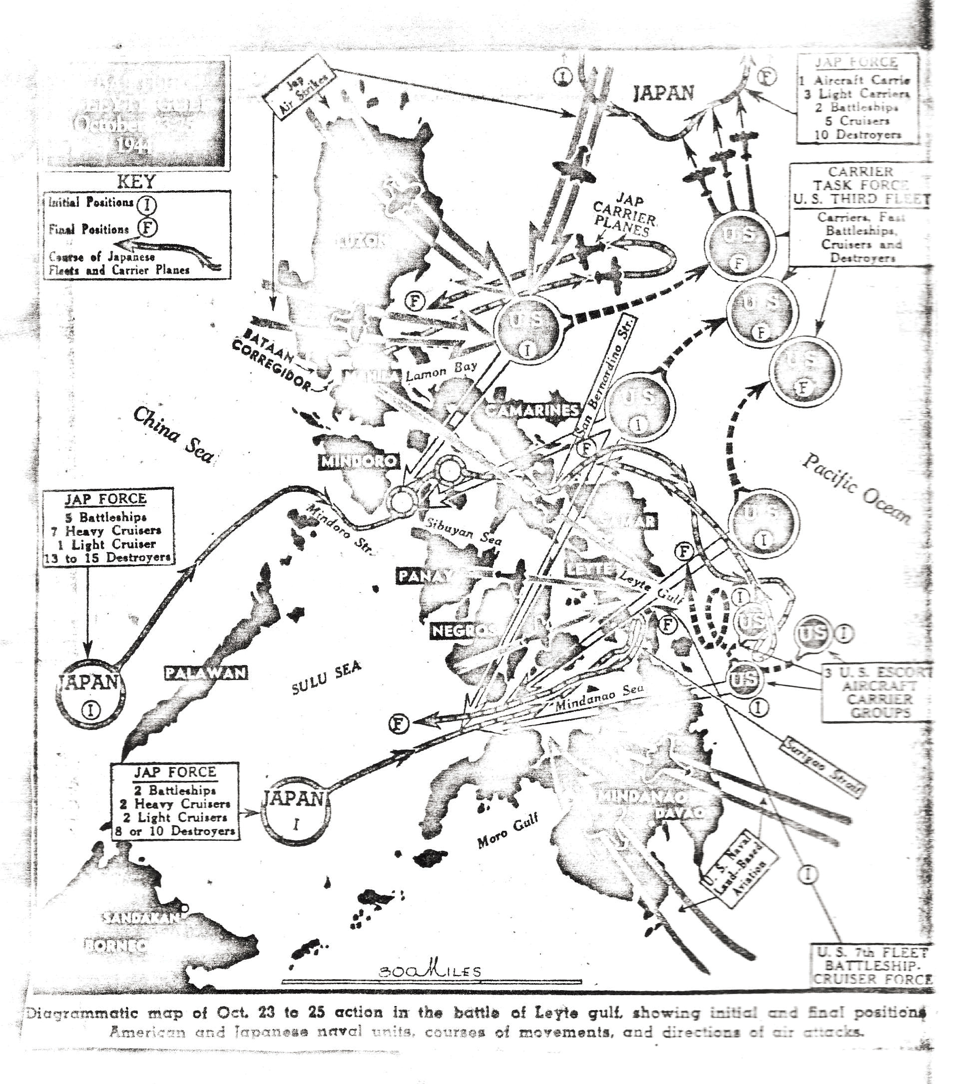 |
| Overview of the Leyte Gulf area showing US and Japan strike forces on October 23-25, 1944. |
This was not a frequented area of the South China Sea due to its many hazards. The only nautical charts of this region were British, and they looked so antiquated the Darter & Dace navigators wondered if they were from the turn of the century. (They probably were; likely the ones used by the Royal Navy when they blockaded the Phillippines during the Boxer Rebellion some fifty years earlier).
All these islands in the Philippines had offshore reefs, sandbars and outcroppings of sharp rocks, with breakers up to twelve miles from the shore. The rocks were easily misidentified as ships from a distance, because of the 'wakes' they left when waves broke over them. Many of the area's obstacles to surface boats could not be seen from the air, as they were submerged beneath choppy waves. Accurate depth soundings had never been taken in many areas. The reefs and rocks caused unpredictable currents. Tropical storms, typhoons and rain squalls had been known to blow up without warning, all of which spelled doom for many ships.
Even submerged, the thin and highly maneuverable subs were not safe. Huge coral reefs of irregular shapes also filled the area, some just below the surface, and radar at the time only detected moving objects, not stationary ones. All these factors made sea travel through this area very perilous.
Grandpa's hand drawn map of the region with latitude and longitude lines helped me locate the final resting place of the Darter on satellite images that I will repost later.
No comments:
Post a Comment